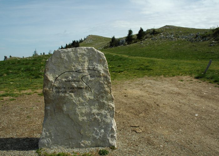
Villiers, Les Planches, Le Pâquier, La Combe-Biosse, Chasseral, la métairie de l’Ile, Chuffort, Clémesin, Villiers
Alternative shorter route is also marked from Le Pâquier to Clémesin.
Find your public transport schedule with : SBB – TransN – PostBus
Your access points for walk2
| Place |
Parking |
Bus stop |
SBB station |
| Villiers |
yes |
Line 422 |
– |
| Chasseral, Hôtel |
— |
Alpine bus in the Chasseral Regional Park
(see schedule)
BUS 32 from La Neuveville, Post Office
BUS 121 from St-Imier, station |
– |
| Map of walk 2 |
 |
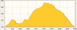
Big loop – (print) 
|
| Distance |
21.4 km |
Duration |
6 h 33 |
| Gain |
1’052 m |
Loss |
1’052 m |
| Highest elevation |
1’556 m |
Lowest elevation |
761 m |
|
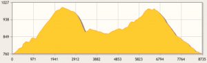
Little Loop – (print)
|
| Distance |
8.9 km |
Duration |
2 h 35 |
| Gain |
404 m |
Loss |
404 m |
| Highest elevation |
1’003 m |
Lowest elevation |
761 m |
|
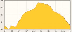
Upper Loop – (print)
|
| Distance |
14.5 km |
Duration |
4 h 35 |
| Gain |
758 m |
Loss |
758 m |
| Highest elevation |
1’556 m |
Lowest elevation |
919 m |
|
Share the post "Walk 2 – Vers Chasseral"